Shetland Flyer Aerial Media was the successful bidder for three peatland survey tenders awarded by NatureScot as part of the Peatland ACTION initiative. These projects included two sites on Yell and a third at the spectacular Hermaness National Nature Reserve on the island of Unst.
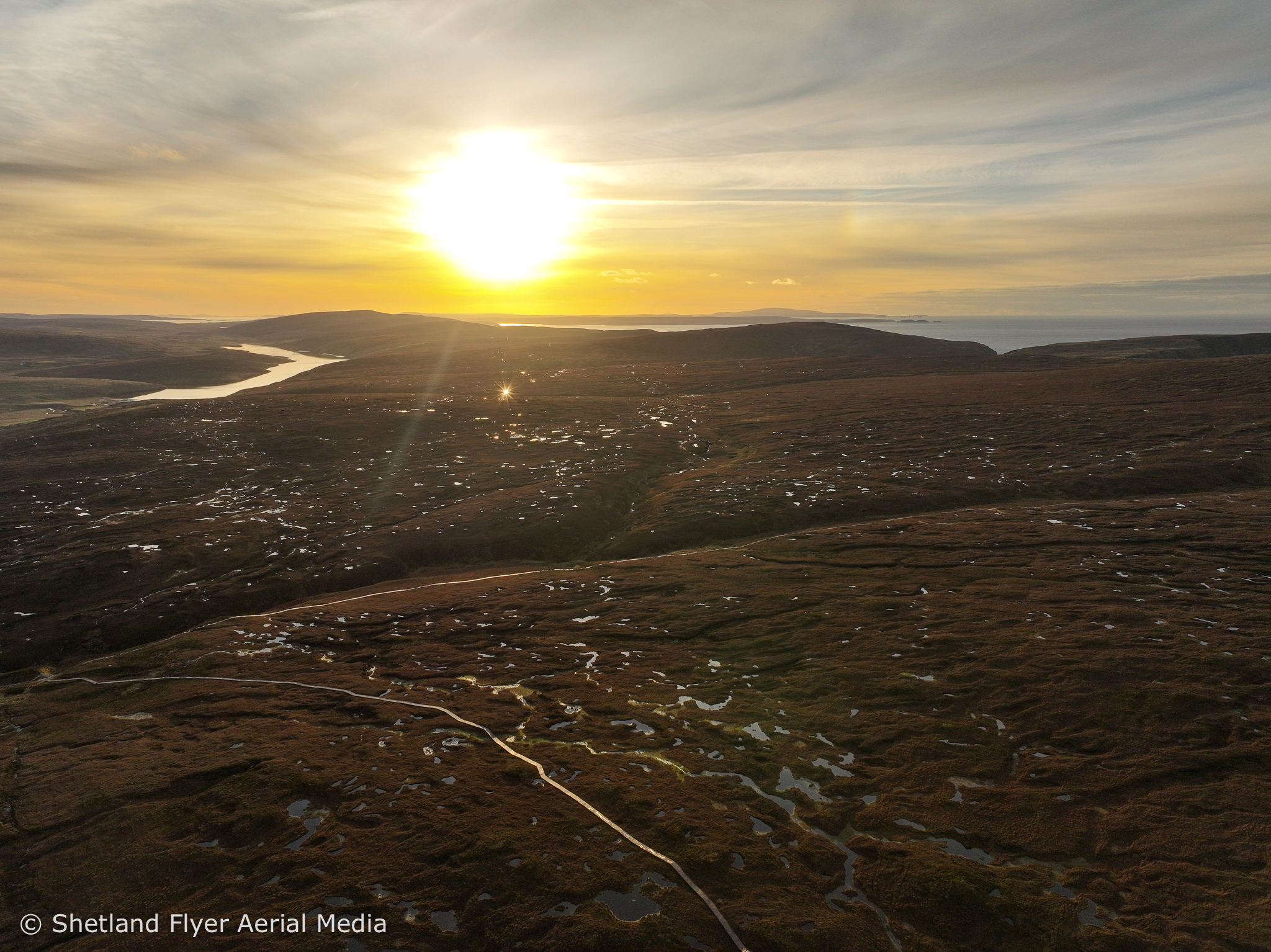
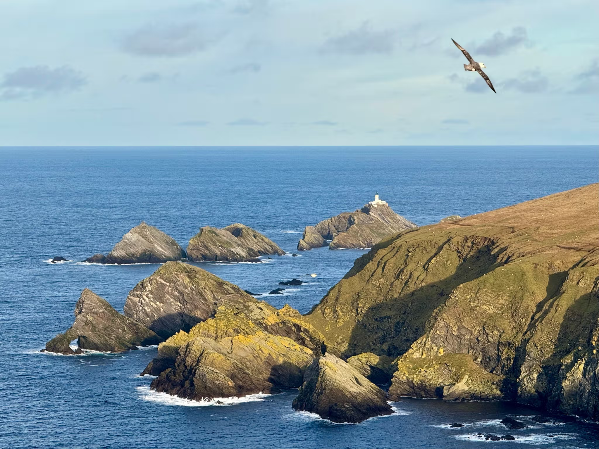
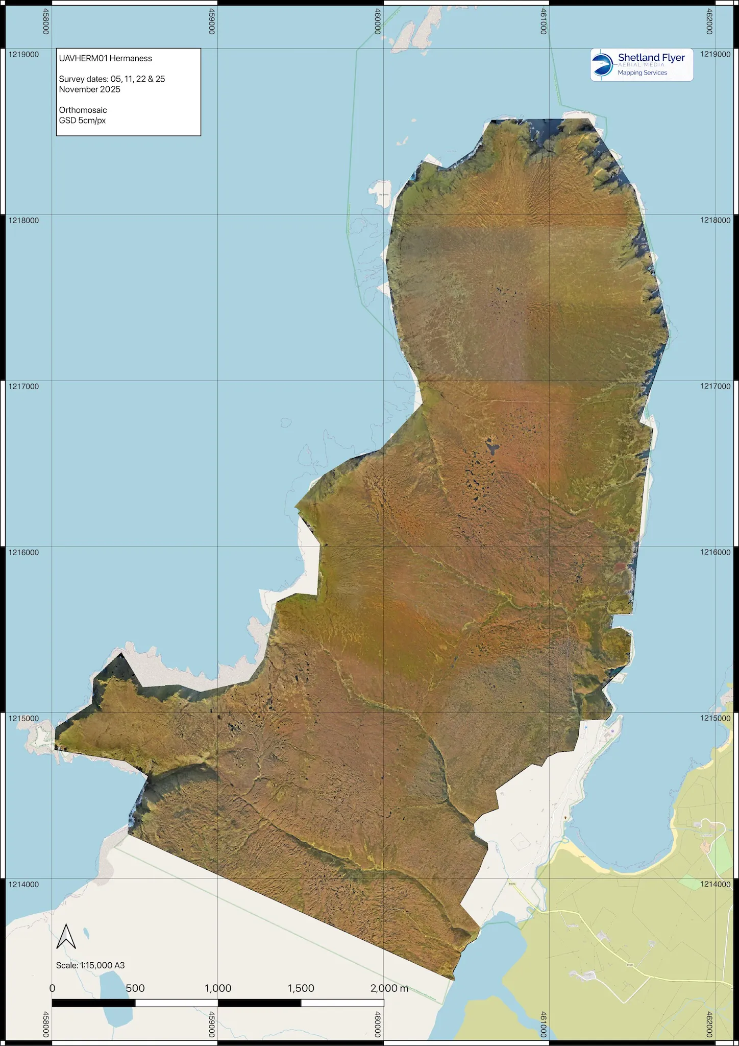
Situated at the very northern edge of the United Kingdom, Hermaness National Nature Reserve encompasses approximately 1,000 hectares of peatland, characterised by dramatic coastal cliffs and an exceptional natural environment. The site is a haven for wildlife, supporting large colonies of gannets, skuas and puffins, along with seals, porpoises, and even occasional sightings of orcas and other cetaceans offshore.
Project Overview
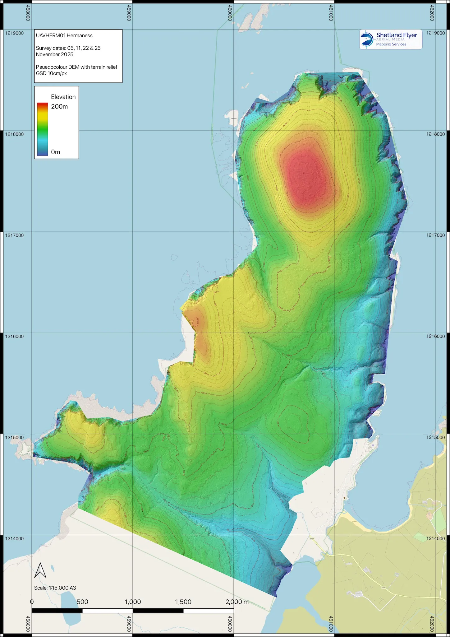
The objective of the survey was to deliver a Digital Elevation Model and orthomosaic at a specified resolution of 10cm per pixel, providing high-quality data to support ongoing peatland restoration work.
To achieve this, we deployed two aircraft: the DJI Mavic 3 Enterprise and the DJI Matrice 4E. Both drones were flown using automated mapping missions at 110 metres above ground level, with Real-Time Terrain Follow enabled to ensure consistent ground sampling distance across the varied terrain.
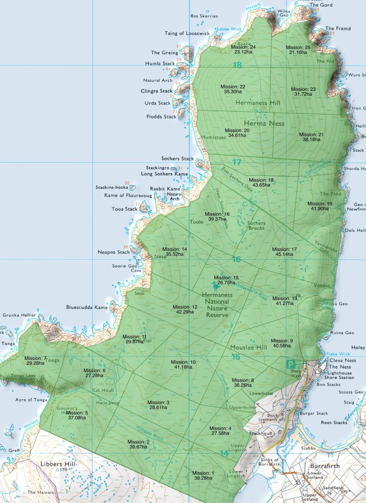
For efficient coverage, the site was divided into 25 mission areas, allowing two pilots to operate adjacent missions simultaneously. Despite the significant constraints posed by short daylight hours and highly variable late-autumn weather, all data acquisition was successfully completed in just three and a half days of flying, between 5 and 28 November 2025.
Field Operations
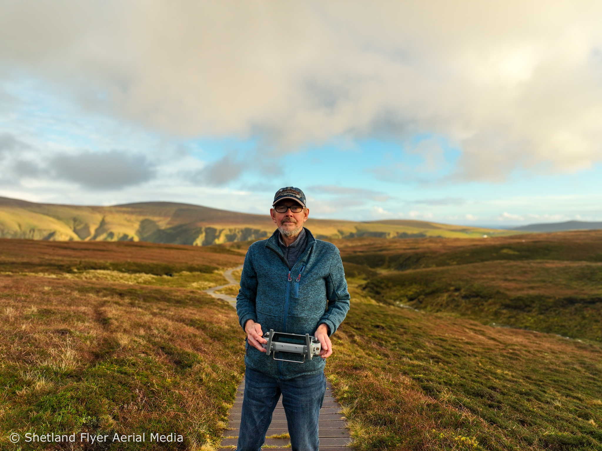
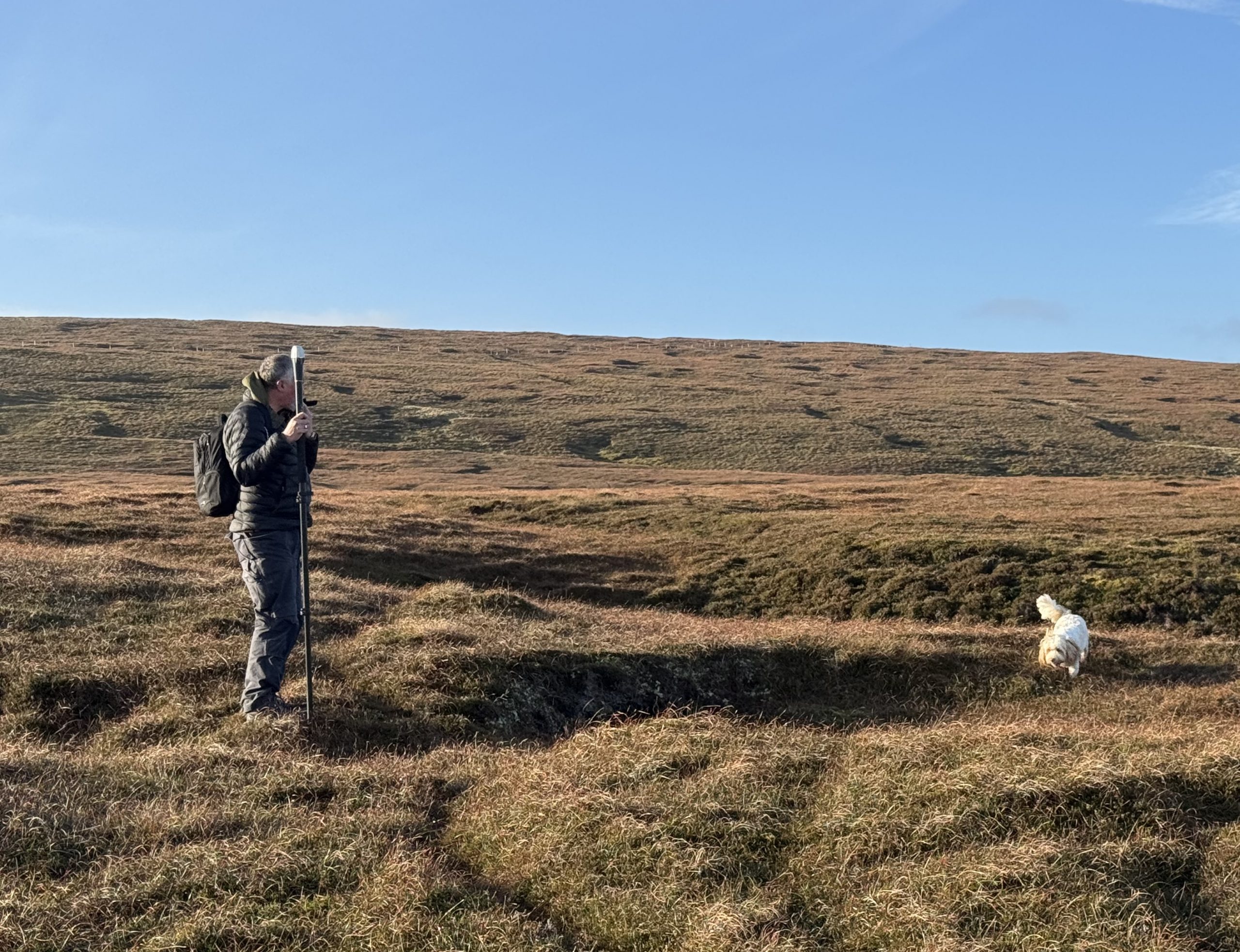
As a designated National Nature Reserve, strict access limitations were in place. The use of vehicles, including ATVs, was not permitted, meaning all equipment had to be transported on foot across the site.
The terrain proved challenging in places, and many missions required hand launching and hand catching of the aircraft due to uneven ground and vegetation cover. Careful planning and disciplined field procedures ensured safe and efficient operations throughout.
Survey Control & Accuracy
Both drones were operated with RTK positioning, supported by an on-site NTRIP base station established near the access road. Fortunately, reliable 4G coverage was available across the entire survey area, enabling consistent RTK corrections.
To further enhance accuracy, we collected a minimum of two ground control points (GCPs) per mission area, with at least one GCP shared between adjacent missions to ensure strong spatial continuity across the dataset.
Data Processing
In total, over 9,000 images were captured during the survey. All data were processed in-house using Agisoft Metashape Pro on our dedicated high-performance photogrammetry workstation.
Although the required deliverable resolution was 10cm per pixel, imagery was captured at an average of 3.1cm per pixel, providing a significantly higher level of detail. This allows for the generation of more detailed outputs or focused analysis of specific areas if required.
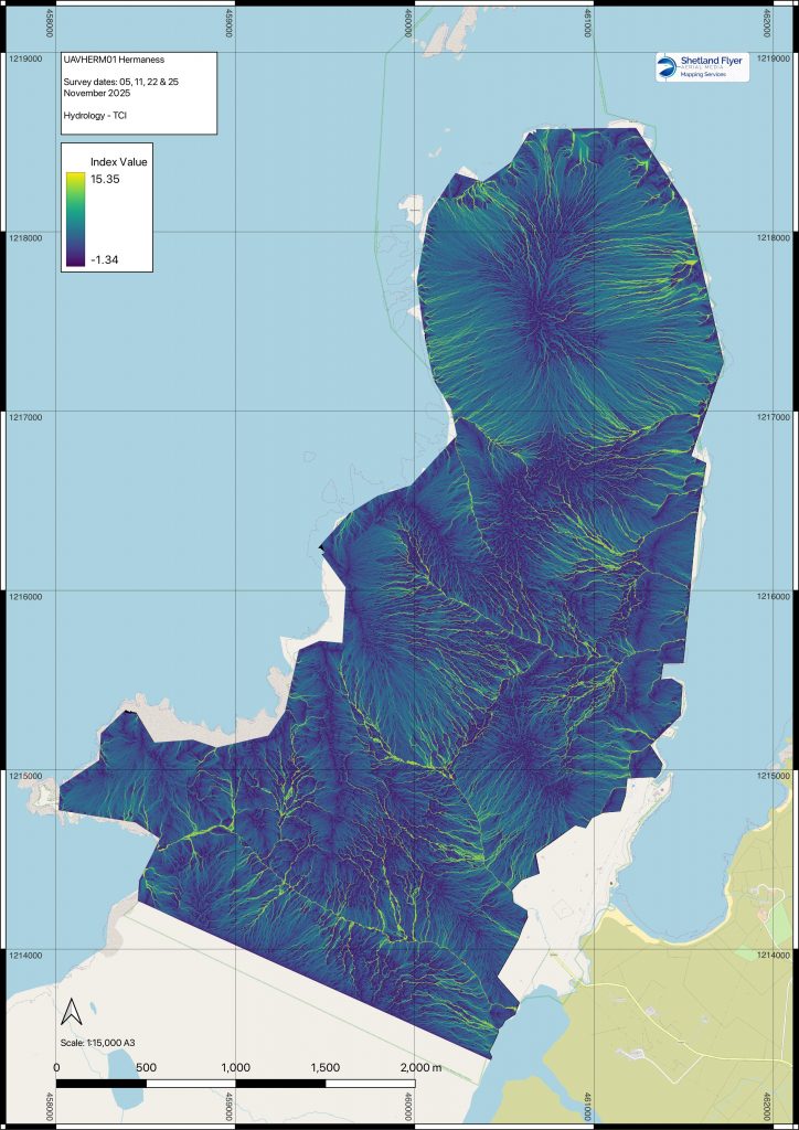
In addition to the specified deliverables, we carried out hydrological analysis on the derived DEM, generating Topographic Convergence Index (TCI) and Flow Accumulation rasters. Flow Accumulation highlights the natural drainage pathways across the landscape, while the TCI assigns an index value indicating the relative wetness of different areas. Together, these datasets provide valuable insight into how water moves across the headland, supporting the identification of drainage patterns and informing targeted peatland restoration measures.
Delivery & Outcomes
Despite the logistical and environmental challenges, all outputs were delivered within the tender timescale — a notable achievement given the limited weather windows available.
The final deliverables successfully passed NatureScot’s stringent quality control procedures, and the data are now being used by peatland officers to inform restoration planning and decision-making across the site.